
In 1997, a staged land release was commenced in Warriewood Valley comprising 1,510 dwellings and 3.7 hectares of employment generating development within 110 hectares of land.
The Warriewood Valley release area now encompasses 195 hectares with an anticipated 2,544 dwellings, associated facilities and infrastructure as well as 3.7 hectares of employment generating development.
The Strategy
The Amended Warriewood Valley Strategic Review Addendum Report (2018) is the contemporary strategic document that informs the development opportunities in the Warriewood Valley Land Release area.
Warriewood Valley Contributions Plan provides the levying of the development contributions that facilitate the delivery of infrastructure in/adjacent to the release area.
Background
The Planning Framework 1997, the STP Buffer Sector Planning Framework 2001, and the Planning Framework 2010 are historic strategic documents that informed the rezoning and development of the Warriewood Valley release area since its inception.
These documents were superseded in 2013 by the Warriewood Valley Strategic Review Report prepared by Pittwater Council in partnership with NSW Department of Planning and Infrastructure, and endorsed by then Director – General of Planning.
This was subsequently amended by the Warriewood Valley Strategic Review Addendum Report in 2014, to address the other properties not afforded a forward planning direction by the original Warriewood Valley Strategic Review.
Prior to 2013
Originally, Warriewood Valley was developed on a sector-by-sector basis, using Sector Masterplans.
These masterplans co-ordinated site development, access and the delivery of infrastructure.
The following Sectors were rezoned and developed in accordance with the Sector Masterplans prepared by the landowner(s):
- Sector 1
- Sector 2
- Sector 6
- Sector 7
- Sector 8 except for 23B Macpherson Street known as Sector 801
- Sector 10 including 109 Orchard Street (now known as Sector 10B)
- Sector 11
- Sector 12
- Sector 20
Incomplete and not developed sections according to Sector Masterplans
- Sectors 301, 302 and 303
- Sector 501 (formerly Sector 5) the Sector Masterplan was not implemented. Individual landowners have now lodged a development application for each parcel.
Post 2013
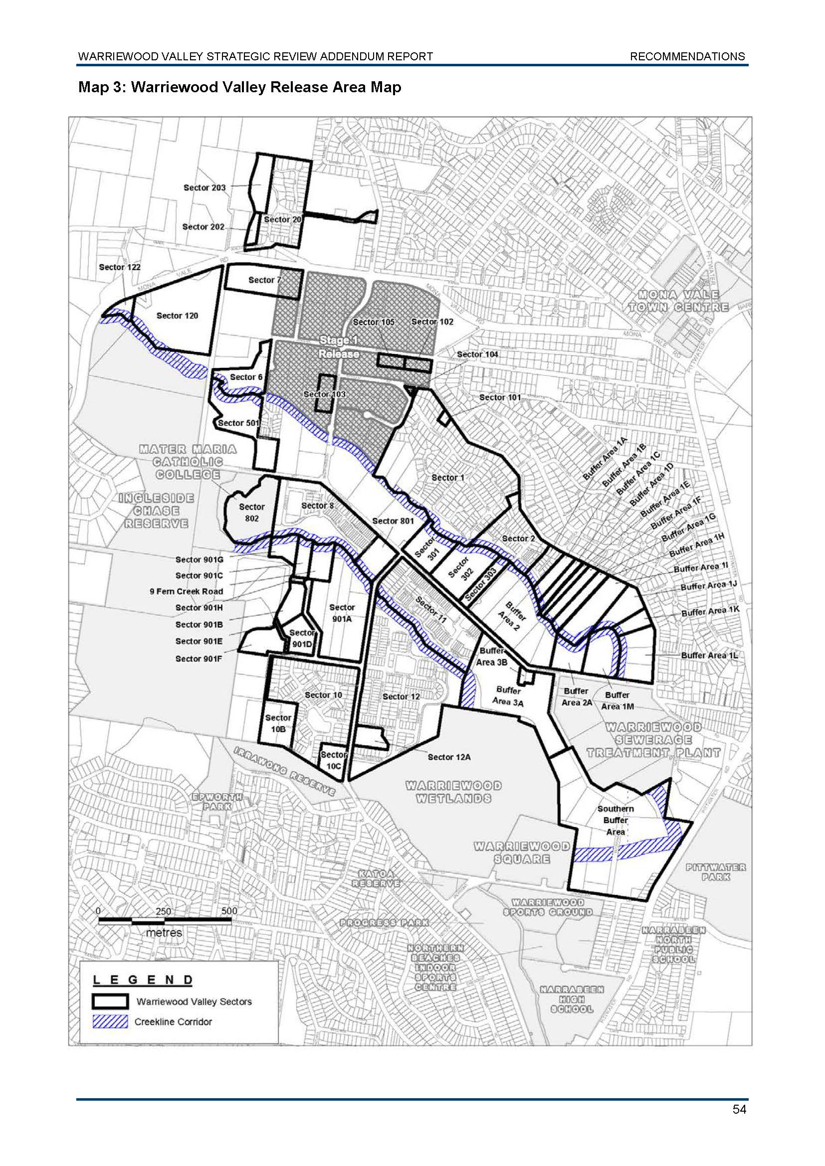
Since 2013, all properties not covered by those Masterplans have been subject to the controls and recommendations contained in the Warriewood Valley Strategic Review Addendum Report. These controls allow the development of remaining sites to be assessed on a case-by-case basis.
The Sectors subject to this document are as per the Land Use Designation Map (found on page 56 of the Addendum Report). View the properties subject to the Addendum report
These documents set out the detailed requirements for the public domain, transport and drainage infrastructure that accompanies any new development in the Warriewood Valley Release Area.
Reference Documents
- Warriewood Valley Release Area Landscape Masterplan and Design Guidelines (2018) 7.5MB
- Warriewood Valley Roads Masterplan (2018)
- Warriewood Valley Urban Land Release Water Management Specification (2001)
Approval under Part 3A
In December 2009, the landowner of 14-18 Boondah Road Warriewood (now known as 79-81 Macpherson Street and Buffer Area 3a) lodged an application to then NSW Department of Planning and Infrastructure for consideration under Part 3A of the Environmental Planning and Assessment Act. The Planning Assessment Commission was the consent authority for this application, and subsequent applications on the subject property.
The Planning and Assessment Commission approved the application on 18 January 2011. Information relating to the Major Project may be viewed via the Planning and Assessment Commission website.