Stage 2 Geography: The Earth's Environment - Manly Dam or Bilarong (Narrabeen Lagoon)
Program overview
Set against the stunning backdrop of either Manly Dam or Bilarong Reserve (Narrabeen Lagoon), this immersive fieldwork experience invites students to explore how a thriving natural environment can exist on the edge of urban development. Through hands-on inquiry, students will investigate the vital role this ecosystem plays in supporting both the local community and native biodiversity.
Students will develop geographical skills by:
- Interpreting and creating maps
- Recording observations through visual and written formats
- Surveying land and water for signs of life
This program fosters a deep appreciation for the interconnectedness of people and place, encouraging students to think critically about environmental stewardship while enjoying a day immersed in nature.
Syllabus inquiry questions
- How does the environment support the lives of people and other living things?
- How do different views about the environment influence approaches to sustainability?
- How can people use places and environments more sustainably?
Learning experiences
Select from two location options:
Manly Dam
Throughout this program, students explore how human dependence on the dam has evolved since European settlement and consider strategies for sustainable management natural spaces like Manly Dam.
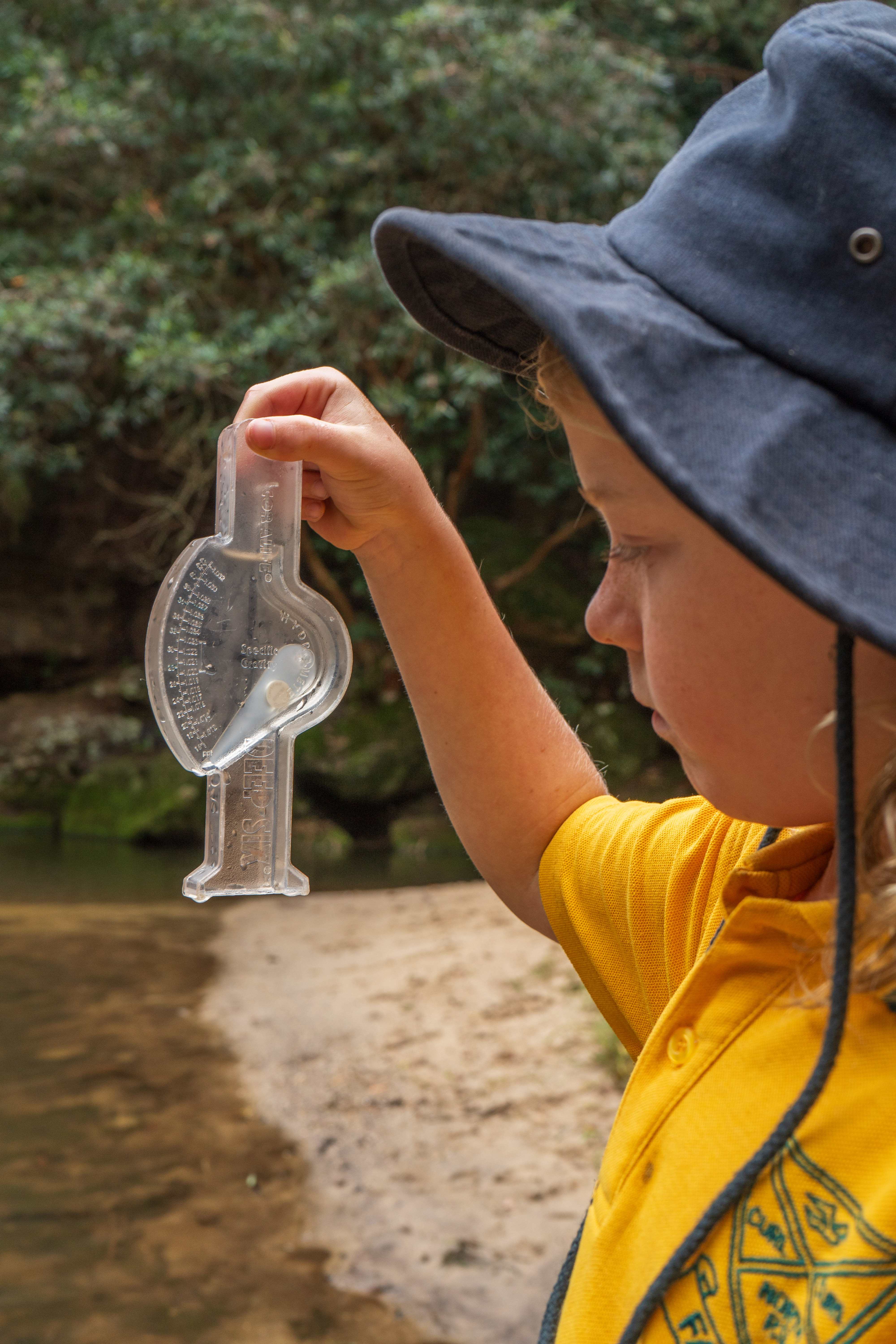
Activities: Students will assess the biotic and abiotic health of the water in the dam and establish links between human activities in the surrounding catchment and their results. They will create a field sketch and use and interpret maps throughout the day, making links to land use, biodiversity and sustainable management.
Bilarong Reserve - Narrabeen Lagoon
This popular reserve is a perfect location to experience the unique ecology surrounding Narrabeen Lagoon, allowing students to appreciate the significance of this natural body of water connecting land and sea. Throughout this program, students will learn about the balance between natural and modified land within the Narrabeen Catchment, and the impact of urbanisation on sensitive environments.
Activities: Students will assess the biotic and abiotic health of the water in the lagoon and establish links between human activities in the surrounding catchment and their results. They will embark on an orienteering activity across the reserve and use and interpret maps throughout the day, making links to land use, biodiversity and sustainable management.
Key syllabus outcomes
Geography: THE EARTH’S ENVIRONMENT
A student:
- examines features and characteristics of places and environments GE2-1
- describes the ways people, places and environments interact GE2-2
- examines differing perceptions about the management of places and environments GE2-3
acquires and communicates geographical information using geographical tools for inquiry GE2-4
Science
A student:
- Students describe some observable changes over time on the Earth’s surface that result from natural processes and human activity ST2-8ES.
Students describe ways that science knowledge helps people understand the effect of their actions on the environment and on the survival of living things ST2-11LW.