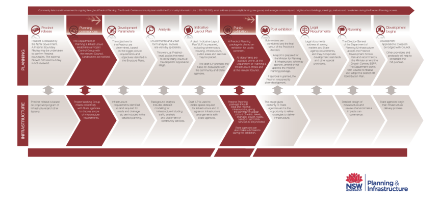
Precinct planning is the key to getting land to market as quickly and sustainably as possible. It is a detailed process which analyses the development potential of any possible land release area.
The process involves detailed investigations to assess the suitability of the land and identify the appropriate land use options by considering the topography, vegetation, bush fire, bush fire mapping, mapping of water courses and the like. Identifying the infrastructure and servicing requirements will be key to these investigations. This analysis will include extensive background studies ranging from Aboriginal and European Heritage to land capability and contamination, noise, odour, transport, biodiversity, bush fire, economics and employment and community facilities and open space, among others.
The process looks at a range of issues and land uses that generally can be found in a new release area, such a vegetation or riparian zones, conservation zones, optimal location of town centres (if any), the mix and type of housing, the key transport routes and linkages. The mapping of land uses will produce an indicative layout plan that, in turn, forms the basis of the planning documents that will accompany any future rezoning of land.
Community participation is embedded throughout this process. Landowners, other stakeholders and the community will be invited to participate at key steps in the process.
Precinct Planning Diagram