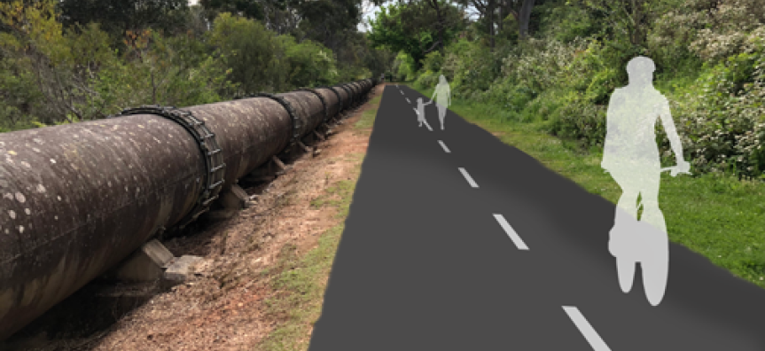
The $7.2m Pipeline Active Transport Corridor project will provide a 9.2km shared user path from Beacon Hill to St Ives, providing walkers and cyclists with a wider, safer connection to communities and destinations.
The off-road path will include new connections and upgrades of existing paths along the Sydney Water pipeline corridor.
The project will be delivered in eight stages starting with section six from Bantry Bay Road to Warringah Road. Currently sections 1 to 3 are not funded and are concept only.
We’re also investigating lighting options that are wildlife-friendly, low-intensity and solar-powered. We’ll provide options to impacted residents before these are installed.
New shared path map 
Breakdown by section
Section 1 - Ku-ring-gai
Falls within Garigal National Park and Ku-ring-gai Council area. Currently an unsealed access road accessible by mountain bikes and bush walkers.
Approx length of 2350m from Hunter Avenue to Middle Harbour Creek via the pipeline trail.
This is part of shared works between Ku-ring-gai Council and Northern Beaches Council which is currently unfunded.
Section 2 - Middle Harbour Creek Bridge
Creek crossing at Middle Harbour Creek. Currently no access across creek at this location. Bushwalking track to “stepping stone “creek crossing located approx. 800m upstream. Potential for a lightweight bridge to be installed.
Approx length of 40m from Middle Harbour Creek to Middle Harbour Creek via Middle Harbour Creek Bridge.
This is part of shared works between Ku-ring-gai Council and Northern Beaches Council which is currently unfunded.
Section 3 - Davidson Trail
Falls partly in Garigal National Park. Partly sealed with rough asphalt or corrugated concrete with very steep gradients. Popular for bushwalking and used by mountain bikes.
Approx length of 40m from Middle Harbour Creek to Middle Harbour Creek via Middle Harbour Creek Bridge.
This is part of shared works between Ku-ring-gai Council and Northern Beaches Council which is currently unfunded.
Section 4 - Prahan Avenue
Section mainly consists of a wide grass access track alongside pipeline. Currently used mainly for recreational walking.
Approx length of 1010m from John Oxley Drive to John Oxley Drive via Prahran Avenue.
Section 5 - Frenchs Forest West
Section mainly consists of unsealed or grass access road alongside pipeline. Currently used mainly for recreational walking.
Approx length of 1580m from John Oxley Drive to Warringah Road using existing unsealed pathway.
Section 6 - Bantry Bay
Part unsealed access track, part sealed access road. Route diverts from Pipeline to allow more direct route to existing Wakehurst Parkway overbridge.
Approx length of 1580m from Bantry Bay road, via Rangers Retreat Reserve and pipeline to Warringah Road.
Section 7 - Manly Dam
Unsealed access track alongside pipeline. This section of track is very popular with mountain bikers and walkers. Corridor forms part of the area’s informal mountain bike network.
Approx length of 1400m from Wakehurst Parkway to Allambie Road via Manly Dam bike trail.
Section 8 - Allambie Heights
Grass verge alongside pipeline. Generally used by walkers and mountain bikers.
Approx length of 650m from Allambie Road to Ethie Road, Beacon Hill via pipeline.
Construction update
- Construction paused.
Contact information
Helpful Documents